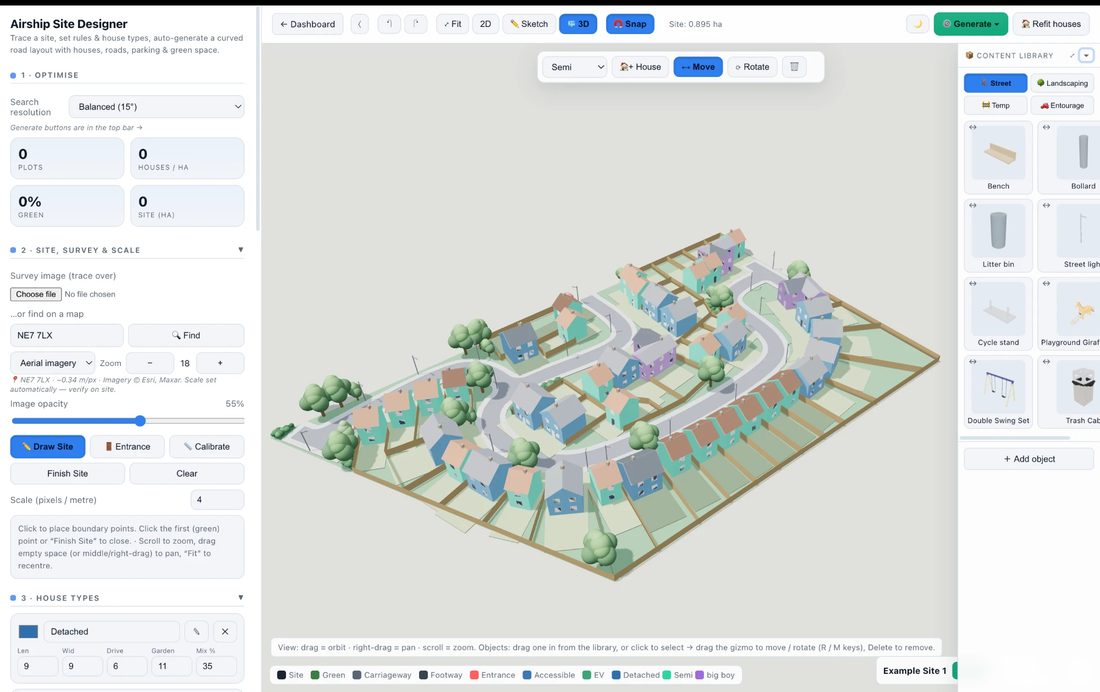
Airship Site Designer turns a site boundary into an optimised housing estate or car-park layout — roads, plots, parking and landscaping — then brings it to life in 3D and photoreal AI renders, ready for DXF, a planning-ready PDF pack or a native Revit model. Find real development land, and know what the scheme is worth before you bid.
No CAD licence, no steep learning curve — just your site and your rules.
Search the brownfield land registers for a real development site, or draw the boundary to scale straight off the map — then set the entrance.
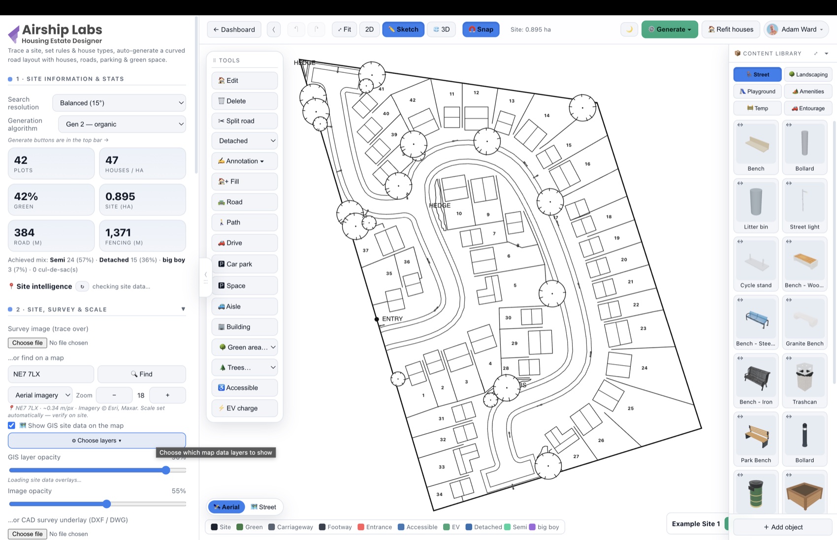
House types & mix, road and footway widths, gardens, bay sizes, green-space target — or load a standards preset.
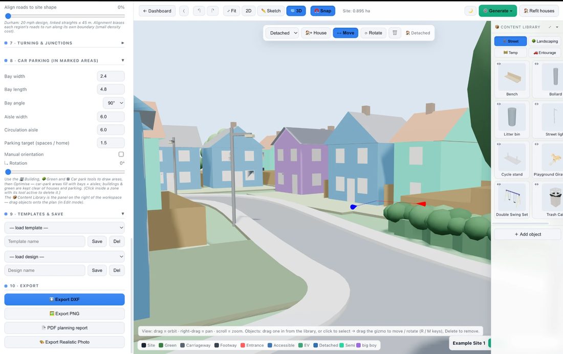
Generate the layout, check it against highway standards, drive a refuse truck or artic through it, walk it in 3D, cost it with the feasibility appraisal — then export DXF, a PDF planning pack or a native Revit model, share a live link, or create an AI photo render for the cover.

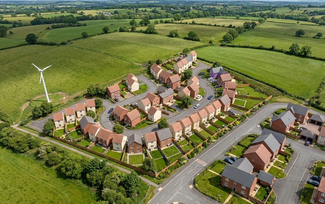
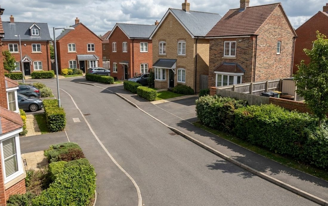
Frame your design in 3D, type a prompt, and get a photorealistic aerial photo of the finished estate — same roads, same plots, real materials.


Works from any angle — aerial or street level. The layout stays true to your design: roads, plots and massing preserved. Included in every plan: Free 3 · Pro 25 · Studio 100 renders a month.
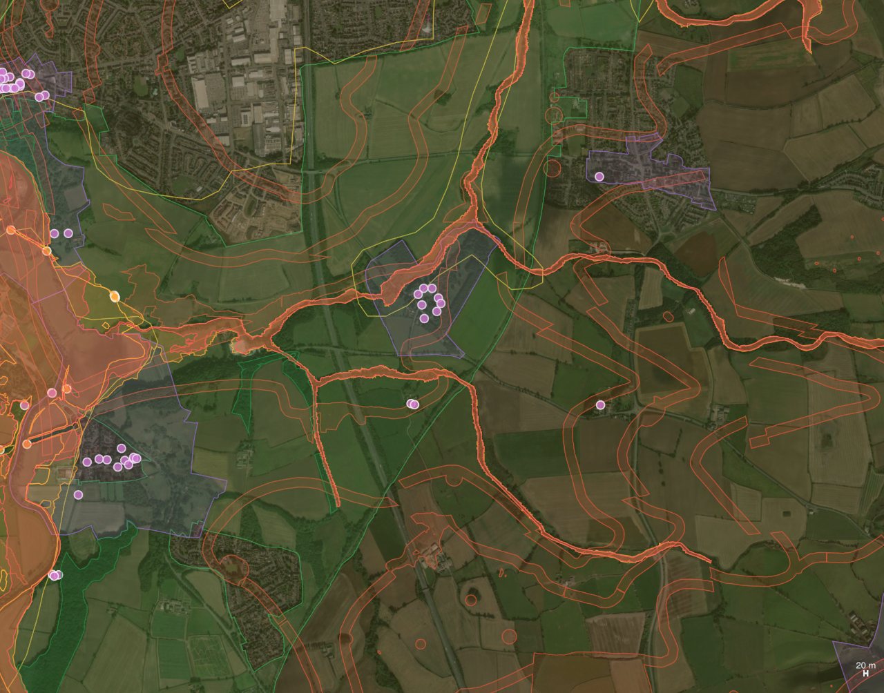
Search a postcode and Airship overlays 48 live GIS layers on your site map — flood zones, green belt, conservation areas, zoning & title boundaries, underground utilities & drainage, historic coal-mining risk, soil types and street-level crime — with an instant site-intelligence report for the exact spot.

Environment Agency Flood Zones 2 & 3, SSSIs, ancient woodland, AONBs and wetlands, plus conservation areas, listed buildings, scheduled monuments, green belt and Article 4 directions — drawn straight onto the aerial photo.
Underground power, pipelines, water & telecom, plus drains, ditches, culverts and manholes — and historic coal-mining legacy from the Coal Authority: development high-risk areas, coalfield consultation zones and licence areas.
Every planning constraint within 1.5 km listed with its distance from your postcode and a link to the official record, plus modelled air quality, the nearest DfT traffic count, flood zone, land use and Census 2021 population — for any UK location.
Pick exactly the layers you need — flood & water, landscape & nature, heritage, zoning & land, utilities & drainage, coal-mining legacy, soil types (USDA SSURGO) and crime rates (police.uk) — with hover tooltips on every area and pin, plus a separate opacity control for the map and the data. GIS overlays are included on Pro, Studio and Enterprise plans. Sources: planning.data.gov.uk, Environment Agency, Historic England, OpenStreetMap, Coal Authority, Open-Meteo, DfT, ONS. Indicative data — always verify with the relevant authority.
Search England's statutory brownfield land registers for sites with real capacity, drop one onto the canvas, generate a layout — then get a full development appraisal costed off the drawing, with a traffic-light verdict.
Search ~37,000 register entries by location, area and dwelling capacity. Every result carries the authority's own estimate of homes, ownership and permission status — and is auto-checked against flood zones, green belt and conservation areas before you open it.
Not a rate per acre. Carriageway metres, footway area, plot and floor areas, fence runs, bays and open space are all measured off the drawing and priced line by line — so a long, thin site costs what a long, thin site actually costs.
Not feasible, Poor, Average, Good or Excellent — banded on profit as a share of GDV, against the 15–20% national planning practice guidance benchmark. Solve for profit at a known land price, or for the most you could pay and still hit your return.
Sales values come from ONS median new-build prices by property type for the local authority, indexed forward on the HM Land Registry new-build house price index — fetched for your site, not typed in from memory.
Affordable housing, CIL, Section 106 and biodiversity net gain — every one editable for the site in front of you, each showing where its default came from. Airship checks the national register and tells you whether your authority has an adopted CIL schedule.
Cover and verdict, the plan with every measured quantity, the full cost schedule, and the assumptions, sensitivity and sources behind it — plus a CSV of every line for your own model.
Shortlist sites and compare them side by side — area, density, permission, local values and an indicative margin. Included on Pro, Studio and Enterprise plans. Sources: planning.data.gov.uk brownfield land registers, HM Land Registry UKHPI, ONS HPSSA (all Open Government Licence). Indicative feasibility only — not a valuation, not a viability assessment, and no substitute for a RICS valuer or quantity surveyor.
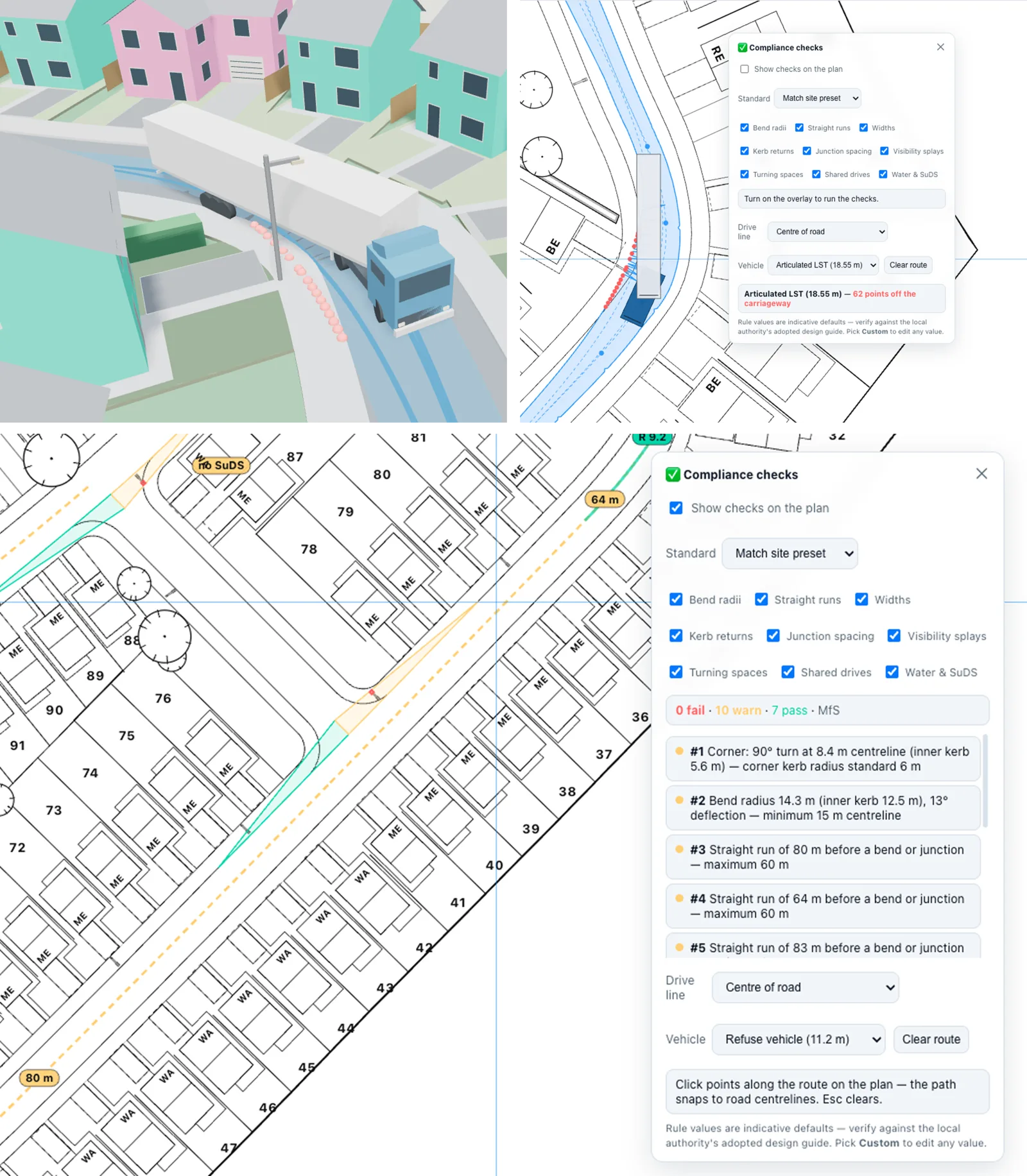
Airship measures your road network the way a highway authority will — and drives real design vehicles through it with true swept-path analysis. Every finding is drawn on the plan, numbered, and reported on dedicated sheets in the PDF and DXF.
Bend radii measured and badged on every curve, X × Y visibility splays traced along the kerb at every junction with obstructions outlined, turning spaces, junction spacing, straight-run and width checks — against Durham, Manual for Streets or your own fully editable rule set.
Refuse truck, fire appliance, car, rigid HGV and articulated HGVs to the 18.55 m UK Longer Semi-Trailer — true tractrix simulation with the trailer chasing the kingpin. UK drive-line conventions built in: hold lane, swing out, or full carriageway width, with opposing-lane use measured in metres.
A numbered key plan with lettered problem areas, a matching findings table, and close-up detail sheets in the PDF — plus CHK_* layers and 2×-scale detail views in the DXF. Watch any vehicle drive the route with animated playback in 2D and 3D, front wheels steering, artics hinging.
Two designers in one — housing estates and surface car parks — with the controls planners and developers actually need.
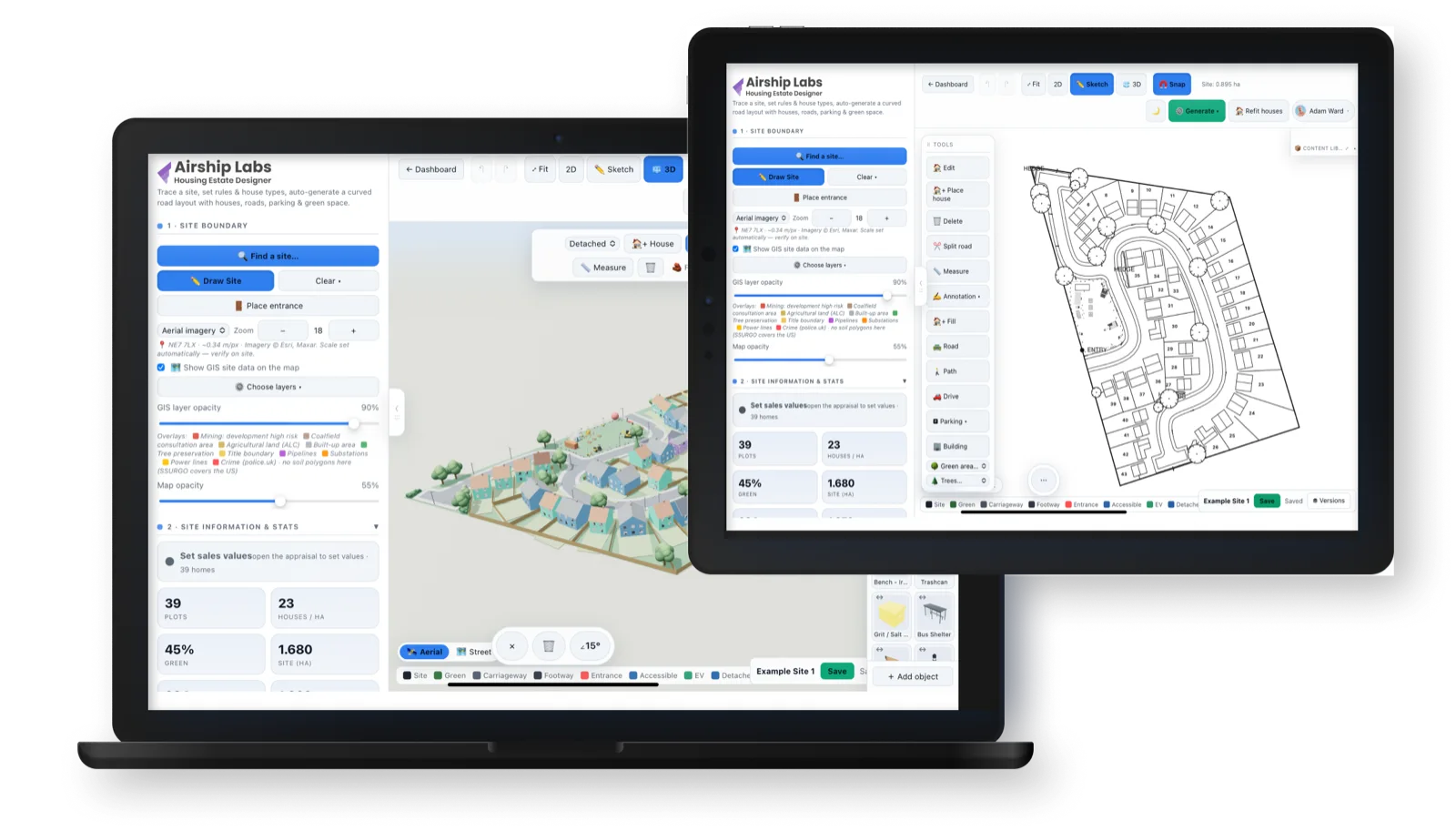
Airship Site Designer runs in your browser today, and a touch-first iPad app is on its way to the App Store. Same account, same designs, same releases — pick up a scheme on the iPad in the field, finish it at your desk.
Pinch to zoom, drag to sketch and edit, long-press to delete, and a floating Done / Delete / rotate bar while you work — the full designer, rebuilt for fingers and Apple Pencil.
DXF, PDF planning reports, native Revit models and AI renders all flow straight into the iOS share sheet — AirDrop them to a colleague or save to Files on the spot.
One account, one project list, one release cycle. Anything you design on the web opens on the iPad — and vice versa — with the same cloud library, GIS data and 3D view.
The iPad app is in final testing ahead of App Store review. Web works beautifully on iPad Safari in the meantime — same touch controls, no install needed.
Explore feasibility and maximise yield in the time it used to take to draw one option by hand.
Answer "how many units fit?" instantly and iterate on the spot in client meetings.
The optimiser packs plots and parking efficiently while respecting your rules and green space.
Live warnings and standards presets keep layouts aligned with highway & parking guidance.
Simple plans for solo designers and studios. Cancel anytime.
A browser-based tool that turns a site boundary into an optimised housing-estate or car-park layout in minutes — roads, plots, parking and landscaping — with full 3D, photorealistic AI renders, and DXF/PDF export for feasibility and planning work.
No. Everything runs in your browser with no CAD licence and no steep learning curve. Trace your boundary (over a survey image or map), set your rules, and generate — you can refine every road, plot and fence by hand afterwards.
Presets for Durham County Council residential design guidance and Manual for Streets are built in — carriageway and footway widths, kerb radii, turning heads, visibility and parking bay dimensions — with live warnings when a layout drifts outside guidance. Outputs are indicative and should be verified against the current adopted local standard.
Yes — layered DXF export drops straight into AutoCAD, the multi-page PDF planning pack covers density, mix, parking ratio and green space, and read-only share links let clients view the live design in their browser with no login.
Yes — Pro plans can export a genuine native Revit file (.rvt) for Revit 2025 or 2026, built in the cloud by a real Revit engine. The site arrives as proper Revit elements: a Toposolid site with garden sub-divisions, road and footway floors, fence walls, your exact house geometry and placed library objects — with options for full houses or footprint pads only.
One click turns your 3D view into a photorealistic aerial or street-level photograph of the finished estate — same roads, same plots, real materials. Every plan includes a monthly allowance (Free 3 · Pro 25 · Studio 100 · Enterprise unlimited).
Yes. The Development Finder searches England's statutory brownfield land registers — around 37,000 entries — by location, area and dwelling capacity, flags flood, green belt and conservation constraints, and puts the site boundary onto the canvas. Once you've generated a layout, the cost feasibility appraisal prices it off the drawing — sales values from local ONS new-build medians, build cost, measured roads and externals, CIL, Section 106, affordable housing and biodiversity net gain — and returns profit, residual land value and a traffic-light rating. Included on Pro and above. It is indicative feasibility, not a valuation.
Start free (2 designs, PNG export, 3 AI renders a month). Pro is £19/month, Studio £79/month, and Enterprise — with SSO, white-labelling and unlimited renders — is priced individually. Cancel anytime.
Free to start — no credit card, no CAD licence.
Start designing today →